
Benbrack [An Bhinn Bhreac]
Good walks are even better shared.
Overview
Benbrack [An Bhinn Bhreac]
Elevation: 720 meters
Prominence: 59 meters
Nestled in the breathtaking Scottish Highlands, Benbrack, or An Bhinn Bhreac, greets hikers with a warm welcome - if by warm you mean chilly winds and stunning vistas.
Geology
The rugged slopes of Benbrack are primarily composed of granite and schist. This robust geological foundation provides not just a striking landscape but also fascinating insights into the ancient forces that shaped these highlands over millions of years. Keep an eye out for interesting rock formations that tell a tale as old as time... or at least as old as a Scottish kelpie!
Routes
The Benbrack Circuit is the most popular route, offering an enjoyable blend of challenging terrain and marvelously scenic views. Covering approximately 9 kilometers, this route can typically be completed in about 4.5 hours, making it ideal for a Sunday ramble with friends or family. Just mind the boggy patches—no one likes soggy socks!
Summit Features
Reaching the summit, you will be greeted with a sturdy stone cairn, standing proud at the mountaintop, seemingly keeping count of the adventurous souls who venture here. The skyline unfolds, revealing the majesty of the surrounding area—a view to kickstart the ‘wow’ factor!
Terrain
Expect a mix of rocky paths and grassy slopes, with occasional boggy sections thrown in to keep things interesting. Proper footwear is essential when tackling the highlands to avoid an unexpected splash or slip!
Views
On a clear day, the views from the summit are nothing short of extraordinary. The shimmering Loch Fyne glistens below, while the imposing Arrochar Alps punctuate the distant skyline. The best seasons for picturesque views are spring and autumn, when the weather cooperates and the Highland air clears.
Hazards
As with any Highland adventure, be prepared for swiftly changing weather conditions—much like a pub's opening hours! Adequate preparation and proper gear will ensure your exploration remains enjoyable. Also, keep your wits about you on muddy paths and rocky outcrops to steer clear of face-to-ground interaction!
Access
Nearest Parking
A small parking area is situated off the A83, just a stone's throw from the trailhead at H101216. Arrive early to nab a position, as parking spots tend to fill quickly with eager hikers.
Public Transport
While buses run from nearby towns, your best bet is to take one to Inveraray, where you can enjoy a pleasurable stroll to the trailhead.
Nearest Town
Inveraray is the closest town to Benbrack, offering quaint streets and local shops to explore.
Facilities
You’ll find charming cafés and pubs in Inveraray where you can grab a refreshing drink or a bite to eat after your hike. Public toilets are also available for your convenience.
History
Name Meaning
An Bhinn Bhreac translates to ‘the speckled peak’ in Scots Gaelic, an apt description for the colourful hues of its rocky and vegetative landscapes.
Significance
The mountain is steeped in cultural significance, resonating with local folklore and traditional Scottish heritage, making it a fitting destination for any history buff or intrepid adventurer.
In summary, Benbrack is a superb destination that combines stunning scenery, interesting geology, and a touch of rich cultural history. Just pack your sense of adventure (and maybe a sandwich) and head on over. Happy hiking!
Explore routes near Benbrack [An Bhinn Bhreac]
Public walks starting within 80 km of this hill. Nearby does not mean a route reaches the summit; check its map and access before setting out.
Route planning notes
These notes describe possible approaches, not verified navigable routes or permission to cross land. Check current paths, local access rules and conditions before setting out.
Benbrack Circuit
A popular circular route starting from the nearby car park that offers stunning views and a relatively gradual ascent towards the summit.
Make a day of it, together
Find someone to share the walk with, or organise a day out along a route you like.
Hill facts and local notes
Classifications
Elevation
499m
1,637 ft
Prominence
125m
Coordinates
54.1434, -7.8462
H101216
OS Map
26
At the Summit
The summit features a large stone cairn and a panoramic view that leaves you breathless, in more ways than one!
Terrain & Geology
The mountain is primarily composed of granite and schist, which gives it a rugged and textured appearance. The geological history of the area adds fascinating insights into the ancient forces that shaped this landscape.
Views & Scenery
On a clear day, one can glimpse the breathtaking expanse of Loch Fyne and the surrounding glens, with the peaks of the Arrochar Alps on the horizon.
History & Heritage
Name Origin
An Bhinn Bhreac translates to ‘the speckled peak’ in Scottish Gaelic, likely referring to the varied colours of the rock and vegetation.
Historical Significance
The mountain holds cultural significance due to its location in the heart of the Highlands, often associated with local folklore and traditional Scottish heritage.
Getting There & Facilities
Check current local access restrictions, parking rules and transport timetables before travelling. These notes do not confirm public access to the summit.
Parking
There is a small parking area off the A83 near the start of the trail (H101216), with enough space for a handful of cars. Arrive early to secure a spot!
Public Transport
Buses run from nearby towns, but your best bet is to catch one to Inveraray and then enjoy a pleasant stroll to the trailhead.
Nearby Facilities
Inveraray boasts a few cafés, pubs, and public toilets, perfect for a pre-hike snack or post-hike pint!
Safety Information
Known Hazards
- Watch out for sudden changes in weather, as conditions can shift rapidly in the Highlands. Muddy paths and rocky outcrops require proper footwear and care.
General Safety Tips
- Check weather conditions before setting out
- Carry appropriate clothing and equipment
- Let someone know your planned route
- Take a map, compass, and GPS device
- Carry emergency supplies: food, water, first aid kit, torch
Hills
Some common questions about the hills answered
Are there group walks up Benbrack [An Bhinn Bhreac]?
Many walkers use Walkmates to join or organise walks with others. You can check for group walks around Benbrack [An Bhinn Bhreac] through the maps
Are there other walkers around Benbrack [An Bhinn Bhreac]?
Activity varies by location and time, but Walkmates lets you see whether others have shared walks or shown interest in this area. Find other people through the walking friends search walking friends for Benbrack [An Bhinn Bhreac] search or of course create your own walk for Benbrack [An Bhinn Bhreac]
Can I organise a walk to Benbrack [An Bhinn Bhreac]?
Yes. If there aren’t any walks listed already, you can create a walk and make it available for others to join.
If you're signed up to Walkmates, you can create a walk to Benbrack [An Bhinn Bhreac].
How do I find a walk up this hill?
There are often multiple ways to walk this hill, depending on experience and route preference. Walkmates helps you explore walks and routes that others have shared.
Can I suggest a new route up Benbrack [An Bhinn Bhreac]?
Yes. You can suggest or create routes to share with others. Walkmates focuses on the social side of walking, so routes are used to help people organise walks and explore areas together, rather than as detailed navigation tools or route libraries.
Other uses really appreciate knowledgeable walkers sharing their routes. Share your favourite route to Benbrack [An Bhinn Bhreac] here
The is an error or something incorrect about this hill. How do I let you know?
We always strive to keep the information on Walkmates as accurate as possible. If you find an error, please let us know through the contact form and we'll aim to correct it as quickly as possible
Community Discussion
Comments
Location
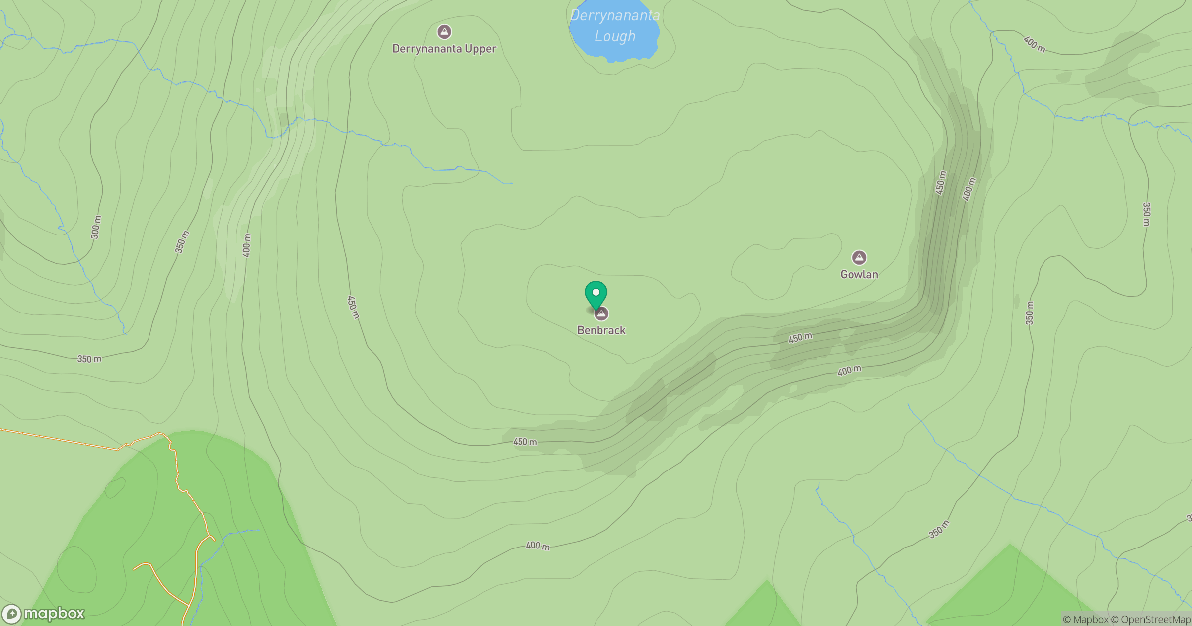
Grid reference: H101216
View on OpenStreetMapOpens a map in a new tab, centred on the hill.
Hills within 30 km
Straight-line distance, not a walking route or confirmation of access.
No comments yet. Be the first.